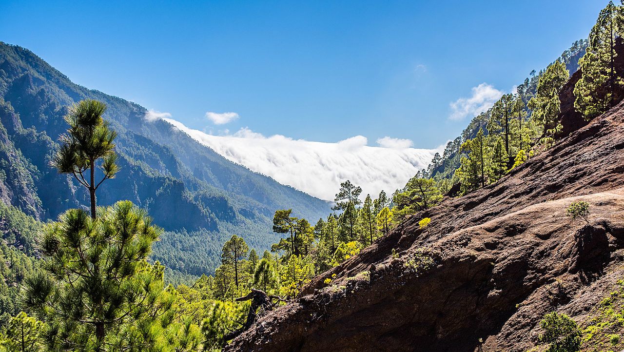
This breathtaking scene is on Los Brecitos. The hike started with a taxi ride of all things. The half-hour ride in a four-wheel-drive vehicle saved you from beginning the day with an incredibly steep hike and deposited you at a gorgeous viewpoint. The forest trail continued through Canary Island pine groves, near endangered Canary Island juniper, and around the Río Taburiente. You stopped to take photos of the Caldera de Taburiente more times than you can count. You took hairpin turns, saw Roque Idafe (a natural stone pillar), and detoured to Cascada Coloradas (a brightly colored waterfall). Then, as you veered back toward the parking lot, the clouds quickly rolled in.
Caldera de Taburiente National Park is more impressive than you ever imagined. Caldera de Taburiente is an enormous crater that’s around two million years old. It was designated a national park in 1954. It’s now home to Roque de los Muchachos Observatory, one of the best astronomical viewpoints in the Northern Hemisphere. Hiking trails, like Los Brecitos, wind around the caldera. It’s somehow remained a peaceful and rarely visited spot.
That’s probably because it’s on La Palma. Aptly nicknamed Isla Bonita (Beautiful Island) is the most northwesterly of the Canary Islands. The seven islands are Spanish, even though they lie off the coast of Morocco. La Palma is one of the smallest islands. Its tiny airport only receives a few flights each day. More than one-third of its land is protected. The rest is full of vineyards, goat ranches, and banana farms. Manolo Blahnik, the island’s most famous son, was born on one of the latter. While Santa Cruz de la Palma, the small capital, is often ignored for the black-sand beaches, the endemic birds, and the volcanic hikes. You’re happy to help keep La Palma a secret if you’re guaranteed the undisturbed beauty you found today.

One thought on “Caldera de Taburiente National Park, Canary Islands”