Villingardalsfjall was obviously worth the hike. It’s a six-kilometer, round-trip hike that usually takes three or four hours to complete. That’s with perfect weather. The weather is rarely perfect here. Fog, rain, and even snow can quickly overpower what started out as a gorgeous, sunny day. The temperature can drop instantly. The wind can make you unsteady on the already rugged, treeless path. Visibility can decrease to just feet or inches in front of you. It can then clear just as quickly.
Not many people hike the Faroe Islands’ third-largest mountain. The reason has more to do with the location than the weather. Villingardalsfjall sits on Viðoy, the island nation’s northernmost island. The capital, Tórshavn, is an hour and a half away. Vágar, where the airport sits, is about the same distance. Most visitors, who only come for a couple of days, don’t leave the central islands.
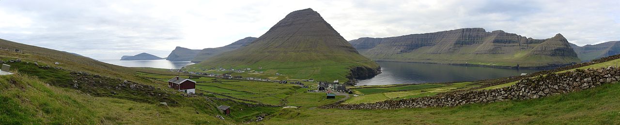
But you were feeling adventurous. With more time than most people, you decided to include some hikes on your itinerary. Fossa (a waterfall) on Streymoy, Slættaratindur (the highest peak) on Eysturoy, and the Kallur Lighthouse on ferry-accessed Kalsoy were added first. Then you read about Viðareiði. The historic town, established between 1350-1400, looked cute enough. It has a 19th-century church, a (supposedly) haunted Old Rectory, and lots of seabirds (Atlantic puffins). Plus its surrounded by dramatic cliffs. So you headed all the way north and found the best view on all of the Faroe Islands.

One thought on “Viðareiði, Faroe Islands”